Modern UAVs (unmanned aerial vehicles) rely on advanced sensors to achieve precise, stable, and intelligent flight performance. Among these, distance laser sensors for UAV play a crucial role by providing real-time and highly accurate distance data between the drone and the ground or target object.
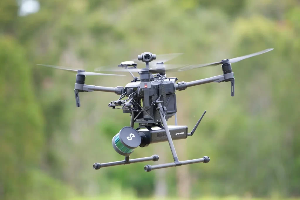
Mounted on UAV gimbals, single-point Détecteurs de distance à laser enable precise altitude control, automatic terrain following, and safe landing operations. This technology has become essential for professional applications such as aerial mapping, industrial inspection, precision agriculture, and environmental monitoring.
Why UAVs Need Laser Distance Sensors
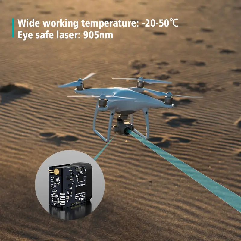
Traditional UAV altitude control systems based on GPS or barometers can suffer from errors caused by temperature, pressure, or weak GPS signals. In contrast, laser distance sensors for UAVs deliver millimeter-level accuracy and instant feedback, ensuring consistent performance even in complex or low-altitude environments.
Their small size, low weight, and high refresh rate make them ideal for UAV integration—especially in gimbal-mounted systems that require precise ground reference data.
Key Advantages of Using Laser Distance Sensors for UAV:
- Real-time altitude and mesure de la distance
- Terrain adaptation and ground following
- Safe and controlled autonomous landing
- Enhanced accuracy for mapping and imaging tasks
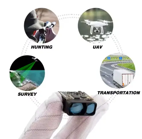
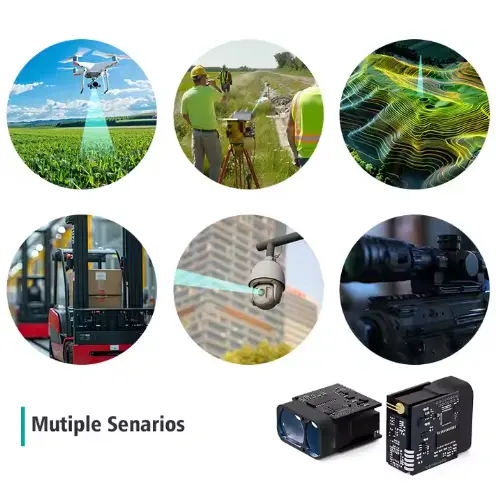
Top Applications of Laser Distance Sensors for UAV
1. Terrain Following and Low-Altitude Flight
In agricultural spraying or mapping drones, maintaining a constant distance from the ground is critical.
Un laser capteur de distance for UAV gimbal continuously measures the ground distance and helps the flight controller adjust altitude in real time.
Purpose:
- Keep flight height consistent over uneven terrain
- Improve spray uniformity and mapping precision
- Avoid ground collision during low-altitude missions
2. Precision Landing and Obstacle Detection
During landing, UAVs require accurate ground distance data to ensure a safe touchdown. Laser distance sensors detect surface height and potential obstacles, allowing smooth, autonomous landing—even in low light or poor visibility.
Purpose:
- Enable precision and automated landing
- Detect rocks, slopes, or irregular ground
- Improve safety during return-to-home operations
3. Target Distance Measurement and Object Profiling
In inspection or mapping missions, UAVs often hover over objects to measure height or distance.
A single-point capteur de distance laser for UAV provides mesure sans contact of buildings, poles, terrain, or stockpiles.
Purpose:
- Measure object height, thickness, or volume
- Analyze deformation or structural displacement
- Support bridge, powerline, or construction inspections
4. Environmental Monitoring: Snow, Ice, and Water Measurement
Laser distance sensors for UAV are widely used in environmental and scientific research. By hovering above surfaces, the sensor measures snow depth, ice thickness, or water levels—providing valuable data for hydrological and climate studies.
Purpose:
- Monitor snow accumulation and melting patterns
- Measure river or lake water levels
- Detect ice layer formation and surface changes
5. Payload Stabilization and Distance Calibration
Laser distance sensors also assist UAV gimbals in maintaining stable camera or LiDAR operation. The sensor continuously provides ground reference data, helping compensate for tilt, altitude drift, or vibration during flight.
Purpose:
- Improve image stability and data accuracy
- Maintain consistent measuring height
- Synchronize visual and distance data for 3D mapping
Key Technical Features of Laser Distance Sensors for UAV
| Fonctionnalité | Typical Value | Advantage |
|---|
| Plage de mesure | 0.1 – 200 m | Ideal for low and mid-altitude UAV operations |
| Précision | ±1 – 30 mm | Enables high-precision ground distance measurement |
| Poids | <50 g | Lightweight, ideal for gimbal integration |
| Refresh Rate | 10 – 100 Hz | Real-time response for flight control |
| Interface | UART / RS485 / CAN | Compatible with major UAV flight controllers |
| Protection | IP65 – IP67 | Weather-resistant and dustproof |
| Temperature Range | -40°C ~ +60°C | Reliable in extreme outdoor conditions |
Recommend : TS1224 Laser range sensor module
Benefits of Using Laser Distance Sensors for UAV Systems
- Higher Flight Accuracy: Provides precise altitude data for stable, controlled movement.
- Amélioration de la sécurité : Enables obstacle détection and smooth autonomous landings.
- Better Data Quality: Enhances imaging, mapping, and inspection accuracy.
- Increased Efficiency: Reduces pilot workload through real-time automation.
- Versatile Use: Works in industrial, agricultural, and environmental UAVs.
Conclusion
Integrating laser distance sensors for UAV is key to achieving next-level flight precision, automation, and safety.
These sensors deliver reliable, high-resolution distance data that allows UAVs to maintain stable altitude, follow terrain contours, and perform precise landings in all conditions.
Compact, lightweight, and robust, laser distance sensors are transforming UAV gimbals into intelligent, autonomous systems that excel in arpentage, agriculture, inspection, and environmental monitoring.
As UAV applications expand, Détecteurs de distance à laser will remain essential for creating smarter, safer, and more autonomous aerial platforms.
Foire aux questions (FAQ)
-
Why are laser distance sensors better than ultrasonic or barometric sensors for UAVs?
A: Laser distance sensors provide faster, more accurate, and temperature-independent distance readings. They outperform ultrasonic or barometric sensors, especially during low-altitude or high-precision operations.
-
Can laser distance sensors for UAV operate in snow, fog, or bright sunlight?
A: Yes. High-quality sensors use strong laser emitters and advanced filtering algorithms, ensuring stable performance even under low reflectivity, snow, fog, or intense light.
-
How do laser distance sensors connect to UAV controllers or gimbals?
A: Most UAV-compatible capteurs laser support UART, RS485, or CAN interfaces, allowing direct integration with flight controllers or gimbal stabilization units for real-time feedback.
-
What measuring range is best for UAV operations?
A: For agricultural or mapping drones, a range of 0.1–100 m is ideal. Long-range versions up to 2000 m are suited for environmental and high-altitude applications.
-
Which UAV applications benefit most from laser distance sensors?
A: They are widely used in aerial surveying, crop monitoring, environmental sensing, power line inspection, and automated landing systems—any mission requiring accurate distance control.