Modern rilevamento has evolved far beyond measuring tapes and optical instruments. In today’s landscape of digitale mapping, GIS systems, and aerial surveys, misurazione della distanza technologies have become smarter, faster, and more precise. Among them, distanza laser sensors—also known as Misuratori laser di distanza or distance detectors—are revolutionizing how professionals collect spatial data.
The Need for Advanced Distance Measurement in Surveying
Surveying often involves large-scale environments, difficult terrains, and long-range targets. Traditional tools can be inaccurate, time-consuming, or even unsafe in rugged or hazardous conditions. That’s why professionals are shifting toward laser per la misurazione della distanza, especially in:
- Topographic and land surveying
- UAV-based mapping
- 3D modeling and terrain reconstruction
- Forest resource monitoring
- Bridge, tunnel, and road inspection
Sensori laser for measuring distance allow surveyors to capture real-time, high-precision data from a safe distance, eliminating the need for physical contact with the object or surface.
Come funzionano i sensori di distanza laser
Sensori di distanza laser operate by emitting a laser beam toward a target and calculating the time it takes for the reflection to return. This method—Time of Flight (ToF), phase-shift, or pulse-based—offers rapid, non-contact, and highly accurate distance measurement.
Key features of modern sensors include:
- Measuring ranges up to 5000 meters
- Accuracy down to ±1 mm
- Real-time response (up to 1 kHz measurement frequency)
- Interface support: RS232, RS485, CAN, or UART
- IP-rated housing for outdoor and industrial use
These capabilities make them ideal laser distance measurers in both static ground applications and mobile systems like drones or robots.
Benefits of Using Laser Sensors in Surveying
1. High Accuracy Over Long Ranges
Unlike ultrasonic or infrared alternatives, laser sensors for measuring distance can maintain ±1 mm accuracy over hundreds or thousands of meters, ensuring reliable results in terrain modeling and cadastral surveying.
2. Misura senza contatto
Surveying across rivers, cliffs, forests, or unsafe sites becomes easier and safer. A sensor sistema di misurazione della distanza eliminates the need to physically access or touch the surface.
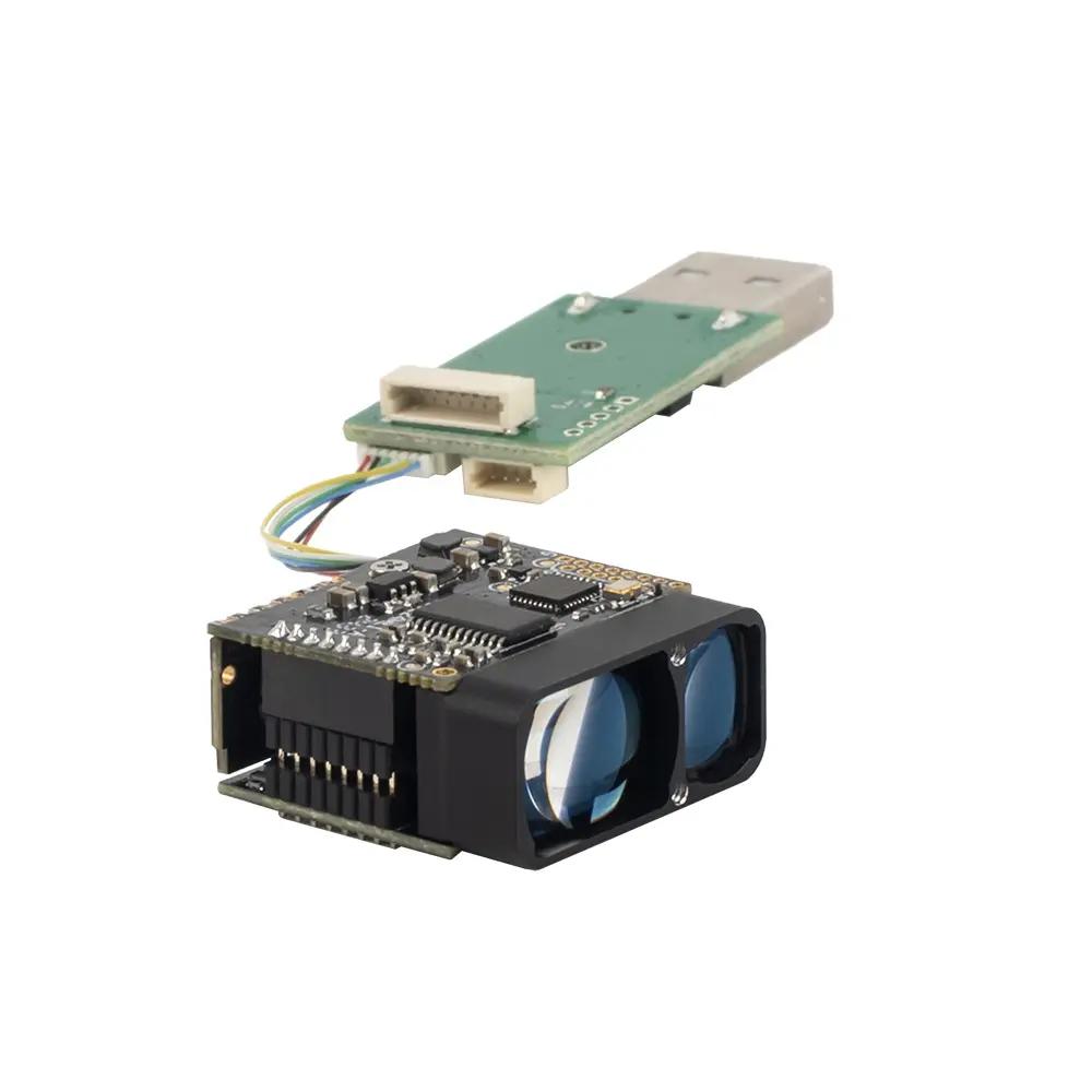
3. Compact and Lightweight for UAV Use
Modules like our TOF sensors are small enough to mount on drones without compromising flight time, making them perfect for laser to measure distance in aerial photogrammetry and LiDAR mapping.
4. Fast Integration and Flexible Communication
Our sensors offer flexible serial interfaces that integrate with GPS modules, IMUs, and onboard computing systems for real-time spatial data processing.
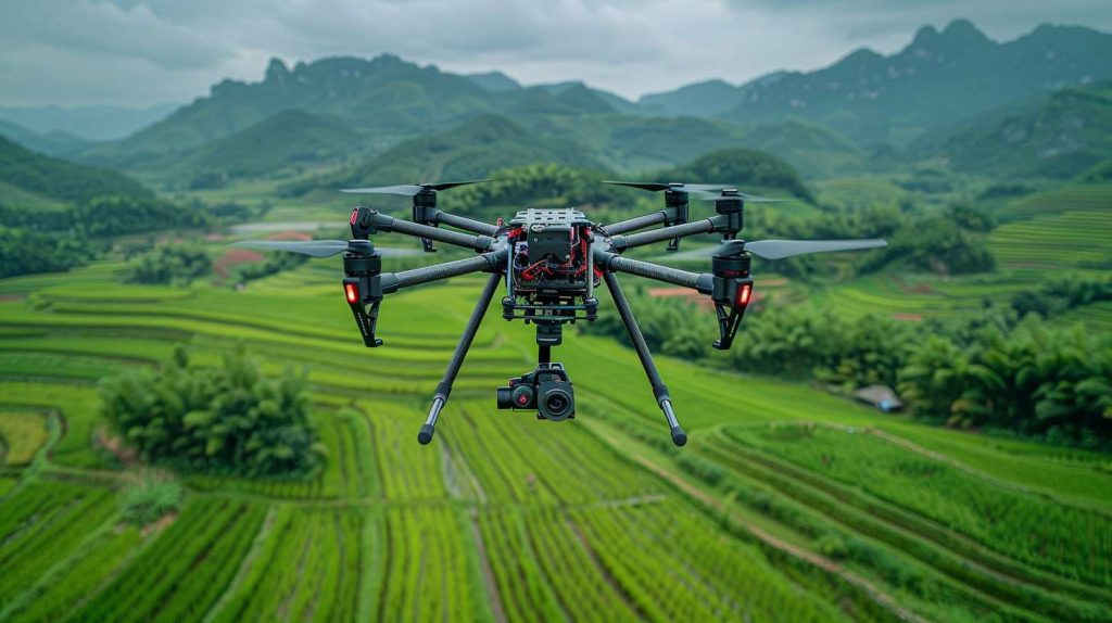
Real-World Application: UAV Terrain Mapping in Central Asia
A leading geospatial company deployed our TS1224 laser module on UAVs for large-area terrain mapping in mountainous regions. The mission required:
- Range: 2000 m
- Accuracy: ±1 m
- Operation in sub-zero temperatures
By integrating the laser per la misurazione della distanza with their onboard GPS/IMU system, they successfully captured accurate topographical data at high altitudes, reducing ground crew workload by 60%.
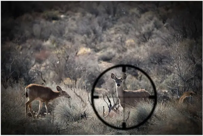 Telemetri da caccia
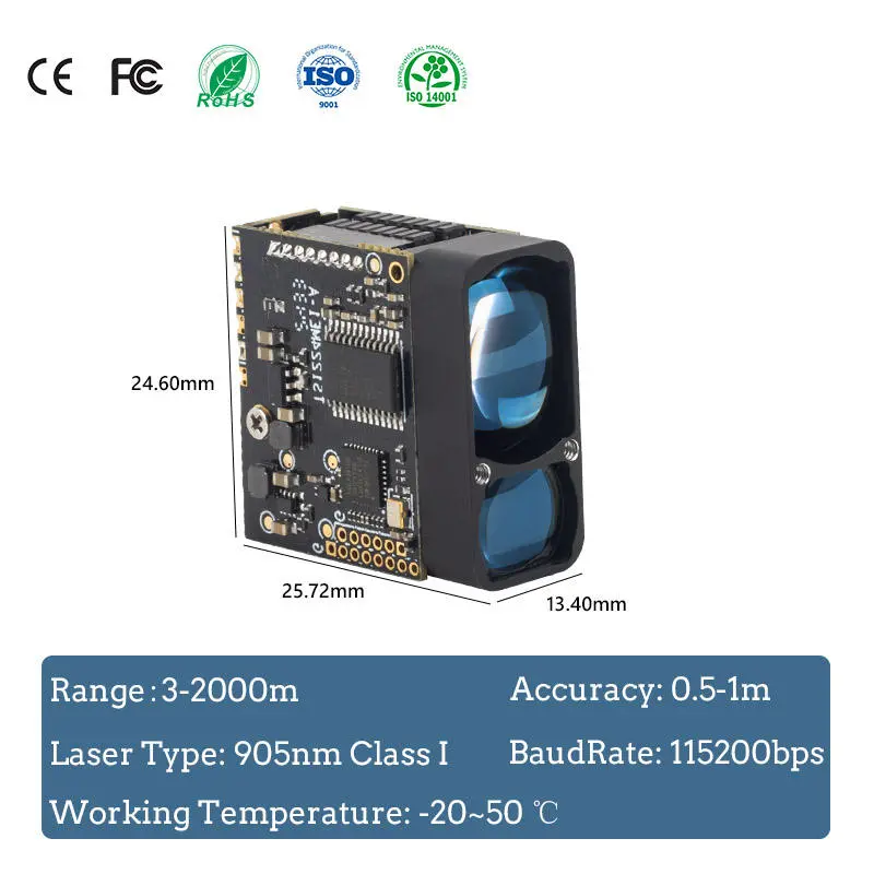
How to Choose the Right Laser Sensor for Surveying
When choosing a distance detector, consider:
Maximum range and required accuracy
Interface compatibility
Environmental conditions (IP rating, temperature)
Target surface reflectivity and texture
| Applicazione | Sensore consigliato | Caratteristiche principali |
|---|
| UAV Mapping | LDJU | Lightweight, 100m range, 1kHz frequency |
| Long-Range Terrain Scanning | TS1224 | Up to 5000m, RS232/RS485 |
| Precision Land Surveying | TC25 | ±1m accuracy, compact size, outdoor-rated |
As digital surveying continues to expand into UAVs, GIS platforms, and real-time 3D modeling, the need for high-precision sensor distance measurement technology is growing rapidly. Laser distance sensors—compact, accurate, and reliable—are leading this transformation.
Whether you’re scanning a bridge, mapping a forest, or conducting terrain modeling by drone, investing in a modern laser misuratore di distanza can significantly improve your workflow and data quality.
🔍 Looking for the Right Laser Sensor for Your Surveying Project?
Contatto our technical team to get a tailored solution