رسم خرائط أمواج المحيطات باستخدام مستشعر ليدار: طفرة في مجال السلامة البحرية
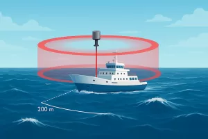
اكتشف كيف يقوم مستشعر LiDAR برسم خرائط لأمواج المحيطات على بُعد 100-200 متر قبل السفن، مما يحسّن سلامة الملاحة والأبحاث البحرية والعمليات البحرية.
اكتشف كيف يقوم مستشعر LiDAR برسم خرائط لأمواج المحيطات على بُعد 100-200 متر قبل السفن، مما يحسّن سلامة الملاحة والأبحاث البحرية والعمليات البحرية.
Discover the best distance sensors for UAV and drones, including laser range finders for obstacle avoidance, mapping, and LiDAR applications.
اكتشف كيف تقوم مستشعرات المسافة بالليزر بتحويل المسح الحديث. تعرّف على حلول قياس المسافة عالية الدقة لرسم الخرائط بالطائرات بدون طيار ونظم المعلومات الجغرافية ونمذجة التضاريس ثلاثية الأبعاد.
Discover how laser distance measurement surveying improves accuracy in land, construction, and tunnel projects. Learn tools, techniques, and terrain-specific solutions.
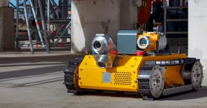
Explore how laser distance sensor for robot enhance mapping, navigation, and SLAM. Discover precision solutions from Meskernel for all robot types.
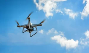
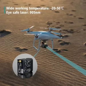
Laser Distance Sensors in UAV applications are revolutionizing how drones perform tasks like terrain mapping, crop height monitoring, precision landing, and water surface measurement. By providing accurate, real-time distance data even in challenging environments, laser sensors enhance the reliability and efficiency of UAV operations. With lightweight designs, high refresh rates, and rugged performance, Laser Distance Sensors in UAV are becoming critical tools across industries such as agriculture, surveying, and environmental monitoring.