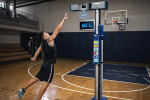
How Non-Contact Distance Sensor Measure Vertical Jump Height Accurately
Learn how non-contact distance sensors accurately measure vertical jump height and display results in real time for sports training systems.
Learn how non-contact distance sensors accurately measure vertical jump height and display results in real time for sports training systems.
A practical guide to choosing an OEM laser distance sensor module for industrial integration, covering performance specs, electrical interfaces, size constraints, and OEM support.
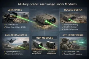
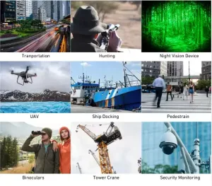
Explore military laser range finder systems designed for long-range, eye-safe and anti-interference performance. Compare consumer vs military-grade modules and learn how OEM laser rangefinder sensors are integrated into UAV, reconnaissance and defense systems.

Get millimeter-accurate height and distance data with a professional distance detector sensor. Perfect for UAV mapping, bridge inspection, and long-range laser measurement in demanding outdoor environments.
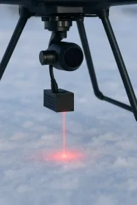
Discover how laser distance sensors for UAV improve altitude control, terrain following, obstacle avoidance, and landing precision. Learn how single-point laser sensors enhance drone stability, safety, and mission accuracy in industrial, surveying, and environmental applications.
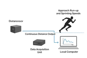
Discover how a high-frequency optical distance measurement system using laser time-of-flight sensors enables continuous non-contact distance measurement and human motion tracking in sports training scenarios. Explore the architecture, challenges and recommended sensor modules.