Preciso medición de la distancia en topografía es la base de la cartografía moderna, construcción planificación, diseño de infraestructuras y análisis de ingeniería. Desde la determinación de los límites hasta la creación digital modelos del terreno, los topógrafos se basan en mediciones de distancia para comprender el mundo físico y convertirlo en datos precisos y utilizables.
Con el avance de las tecnologías -especialmente los sistemas basados en láser y de largo alcance Tiempo de vuelo (ToF), la topografía es ahora más rápida, segura y eficaz. Esta guía explica cómo funciona la medición de distancias en topografía, qué herramientas se utilizan, las ventajas de la tecnología láser y cómo seleccionar el instrumento de medición de distancias adecuado para las distintas aplicaciones.
1. ¿Qué es la medición de distancias en topografía?
La medición de distancias en topografía se refiere al proceso de determinar la distancia horizontal, vertical o inclinada entre dos puntos geográficos. Esta medición es esencial para la cartografía, los planos de construcción, los cálculos de ingeniería, la gestión de recursos y el diseño de infraestructuras.
Los topógrafos utilizan diversas herramientas, que van desde cintas e instrumentos ópticos hasta medición láser y estaciones totales- para obtener datos de distancia fiables. A medida que los flujos de trabajo topográficos se orientan hacia la automatización y la cartografía digital, los instrumentos basados en láser y Sensores TOF se están convirtiendo en la norma del sector.
2. Por qué es importante la medición de distancias en topografía
La medición coherente y precisa de distancias en topografía garantiza:
- cartografía fiable de las características naturales y los entornos construidos
- planificación adecuada de carreteras, oleoductos, ferrocarriles y estructuras
- excavación y movimiento de tierras seguros
- definición correcta de los límites y subdivisión del terreno
- cálculos precisos de altura, pendiente y alineación
Un pequeño error de medición puede dar lugar a costosos errores de ingeniería. Por eso, las herramientas láser avanzadas están sustituyendo rápidamente a los métodos manuales u ópticos.
3. Métodos habituales de medición de distancias en topografía
Los topógrafos utilizan diferentes técnicas de medición en función del alcance, el terreno y la precisión requerida.
3.1 Cinta métrica
El método tradicional utiliza cintas de acero o cintas de fibra de vidrio.
Ventajas: sencillo, barato.
Limitaciones: poca precisión en distancias largas, sensible a la flecha, la temperatura y los errores humanos.
Adecuado para mediciones de corta distancia en interiores o en campo plano.
3.2 Medición óptica de distancias
Instrumentos como los teodolitos y los tránsitos estiman la distancia mediante lecturas estadimétricas.
- Requiere línea de visión y cálculo manual
- Depende de la habilidad del usuario
- Más lenta que las técnicas modernas
Útil en pequeños proyectos topográficos, pero cada vez más anticuado.
3.3 Medición electrónica de distancias (EDM)
Los instrumentos EDM de las estaciones totales utilizan señales de infrarrojos o microondas para calcular la distancia.
- Precisión profesional
- Adecuado para trabajos de topografía, construcción y geodesia
- Requiere configuración y calibración
La electroerosión es un componente estándar de los modernos sistemas de estación total.
3.4 Medición láser de distancias
Los dispositivos láser son actualmente las herramientas más utilizadas para medir distancias en topografía.
Las ventajas incluyen:
- capacidad de largo alcance (de cientos a miles de metros)
- medición rápida puntual y continua
- alta precisión incluso en exteriores
- ligero y fácil de integrar en equipos topográficos
Este método es ideal para la construcción, la cartografía, UAV topografía y proyectos industriales.
3.5 Sensores de distancia de tiempo de vuelo (ToF)
Los sensores ToF calculan la distancia en función del tiempo que tarda un pulso láser en regresar desde un objetivo.
- alta frecuencia de medición (10-100 Hz)
- rendimiento fiable a larga distancia
- Adecuado para UAV de mantenimiento de altitud, minería, silvicultura y cartografía industrial.
- se integra bien a través de interfaces serie (UART/RS485/RS232/CAN/analógica)
Los dispositivos ToF se utilizan cada vez más en sistemas avanzados de topografía y cartografía en tiempo real.
4. Cómo miden la distancia los dispositivos láser
La medición por láser se basa en varios principios físicos. Comprenderlos ayuda a seleccionar el dispositivo adecuado.
4.1 Tiempo de vuelo (ToF)
Un pulso láser viaja hasta el objetivo y vuelve.
Distancia = (Tiempo × Velocidad de la luz) ÷ 2.
Ventajas:
- admite grandes alcances (hasta 2000-3000 m)
- estable en diversas condiciones exteriores
- ideal para topografía, vehículos aéreos no tripulados, minería, silvicultura
4.2 Medición del desfase
Mide la diferencia de fase entre las ondas láser continuas emitidas y recibidas.
Ventajas:
- precisión milimétrica
- ideal para distancias cortas y medias
- utilizados en la medición industrial de alta precisión
4.3 Triangulación
Basado en el desplazamiento del punto láser en un sensor.
Ventajas:
- precisión extremadamente alta
- lo mejor para medir distancias cortas
- utilizados en la inspección industrial y robótica
Este método es adecuado para la topografía precisa en interiores o la medición estructural.
Para que los ingenieros seleccionen el láser adecuado sensor de distancia o telémetro láser consulte nuestro Guía de selección de sensores láser de distancia para una comparación detallada de las tecnologías de fase y pulso.
5. Factores que afectan a la precisión en la medición láser de distancias
La precisión topográfica depende de múltiples factores medioambientales y técnicos:
- reflectividad del objetivo (las superficies oscuras o rugosas reducen la precisión)
- luz ambiente intensa interferencias
- niebla, lluvia o polvo dispersión del haz
- calidad y transmitancia de las lentes ópticas
- potencia del láser y tamaño del punto
- algoritmos de tratamiento de señales
- estabilidad del dispositivo y ángulo de montaje
Los instrumentos profesionales de medición de distancias utilizan procesamiento multieco, control automático de ganancia y óptica de alta eficacia para mantener la precisión en condiciones exteriores difíciles.
6. Tipos de instrumentos de medición de distancias en topografía
Los distintos proyectos requieren herramientas. A continuación se indican los tipos más comunes de instrumentos utilizados para medir distancias en topografía.
- fácil de usar
- adecuado para la medición de edificios y tareas de campo sencillas
- alcance y precisión limitados
- capacidades de largo alcance
- medición precisa en exteriores
- ideal para levantamientos topográficos, silvicultura y estudios medioambientales
Estos dispositivos son esenciales para ingenieros y profesionales de la topografía que necesitan datos de campo rápidos y fiables.
6.3 Total de estaciones con EDM
- combina medición de ángulos + medición de distancias EDM
- alta precisión para el posicionamiento de construcciones, límites de terrenos y proyectos de infraestructuras
- requiere trípode
Las estaciones totales siguen siendo una de las herramientas topográficas más utilizadas.
- admite interfaces serie (UART, RS485, RS232, CAN, 0-10 V analógico)
- medición de alta frecuencia (datos en tiempo real)
- ideal para cartografía con UAV, automatización, minería y estudios de infraestructuras a gran escala
Estos sensores se utilizan cada vez más en sistemas topográficos avanzados que exigen automatización o integración con robótica y drones.
7. Casos de uso de la medición láser de distancias en topografía
Los dispositivos de medición láser son extremadamente versátiles. A continuación se indican las aplicaciones de mayor impacto en los sectores topográficos modernos.


7.1 Levantamientos topográficos y terrestres
La medición de distancias por láser en topografía es la opción preferida para:
- cartografía del terreno
- medición de la pendiente
- perfil de elevación
- creación de modelos digitales del terreno (MDT)
Los topógrafos pueden recopilar rápidamente datos precisos de largo alcance, incluso en terrenos irregulares.
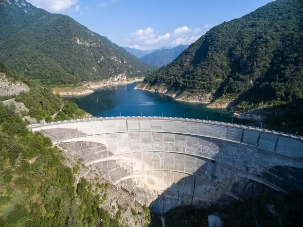
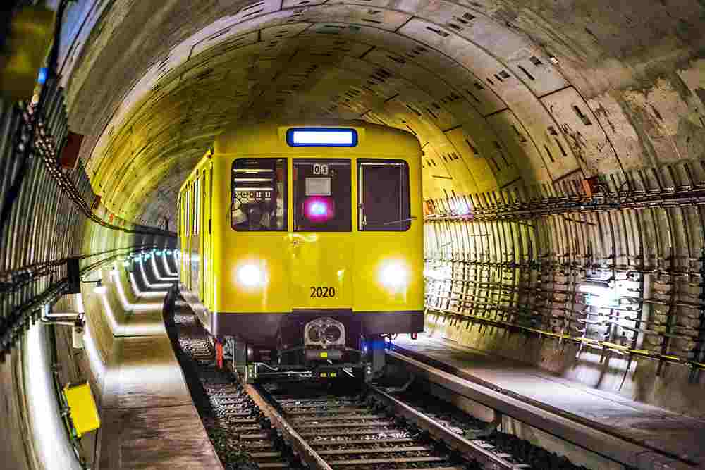
7.2 Ingeniería de puentes y túneles
Distancia láser soportes de medición:
- alineación estructural
- control de deformaciones
- posicionamiento preciso
- medición de grandes distancias en espacios oscuros u obstruidos
Esto es vital para una ingeniería civil segura y precisa.
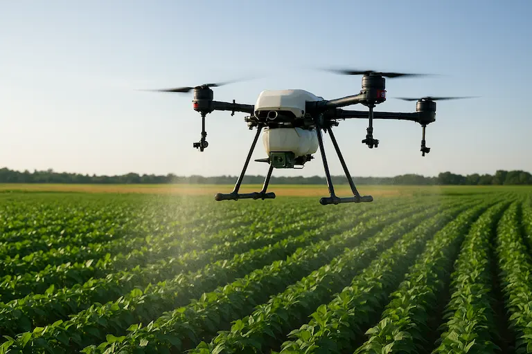
7.3 Control de altura del UAV y seguimiento del terreno
Los drones dependen en gran medida de las mediciones láser para:
- retención de altitud
- exploración del terreno
- LiDAR o asistencia fotogramétrica
- vuelo seguro en paisajes accidentados
- misiones cartográficas de largo alcance
Los sensores ToF de alta frecuencia garantizan datos de altitud estables y en tiempo real.
7.4 Vigilancia forestal y medioambiental
Los dispositivos láser permiten:
- medición de distancias a través de huecos de vegetación
- estimación de la altura de los árboles
- vigilancia del terreno bajo un dosel denso
- cartografiar los límites de los bosques
Funcionan bien incluso con superficies naturales poco reflectantes.
7.5 Medición de los límites de la mina y control del pozo
La topografía por láser garantiza:
- cálculo preciso del volumen del pozo
- vigilancia de la estabilidad de taludes
- medición de límites
- escaneado de largo alcance en condiciones polvorientas o difíciles
Estas mediciones mejoran tanto la seguridad como la planificación.
7.6 Planificación de rutas por ferrocarril y carretera
La planificación de infraestructuras requiere precisión a largo plazo.
Medición láser de distancias asiste con:
- verificación de la alineación
- evaluación de pendientes y terrenos
- cartografía de corredores
- medición en zonas inaccesibles o peligrosas
Los topógrafos pueden obtener datos fiables sin interrumpir el tráfico ni exponer al personal a peligros.
8. Cómo elegir el instrumento de medición de distancias adecuado
Al seleccionar un dispositivo para medir distancias en topografía, tenga en cuenta:
- Rango de medición (por ejemplo, 0,1-2000 m)
- Requisitos de precisión (mm a cm)
- Velocidad de medición (Hz)
- Tipo de interfaz (USB, UART, RS485, RS232, CAN, analógico)
- Rendimiento medioambiental (niebla, luz solar, polvo)
- Calidad óptica y clase láser
- Consumo de energía (importante para los vehículos aéreos no tripulados)
- Compatibilidad de montaje e integración
Un instrumento bien seleccionado reduce los errores en los datos y garantiza un trabajo de campo eficaz.
9. PREGUNTAS FRECUENTES: Medición de distancias en topografía
-
¿Qué es la medición de distancias en topografía?
La medición de distancias en topografía se refiere a la determinación de la distancia horizontal, vertical o inclinada entre dos puntos utilizando herramientas como cintas, dispositivos láser y estaciones totales.
-
¿Por qué se utiliza tanto la tecnología láser para medir distancias en topografía?
La tecnología láser ofrece capacidad de largo alcance, lecturas rápidas y gran precisión, por lo que es ideal para la topografía en exteriores, donde las herramientas tradicionales tienen dificultades.
-
¿Qué instrumentos se utilizan habitualmente para medir distancias en topografía?
Las herramientas incluyen medidores láser portátiles, telémetros láser topográficos, estaciones totales con EDM y sensores ToF de largo alcance.
-
¿Cuál es la precisión de la medición láser de distancias?
Los dispositivos láser de alta calidad proporcionan una precisión de milímetros a unos pocos centímetros, en función del alcance y las condiciones ambientales.
-
¿Dónde se utiliza la medición láser de distancias en topografía?
Entre sus aplicaciones se incluyen la cartografía topográfica, el seguimiento del terreno con UAV, la minería, la silvicultura, la topografía de túneles y la planificación de carreteras y vías férreas.
La medición de distancias por láser en topografía ha transformado la forma en que ingenieros, topógrafos y operadores de vehículos aéreos no tripulados capturan datos espaciales. Con capacidad de largo alcance, alta precisión y excelente rendimiento sobre el terreno, los sistemas de medición láser son ahora esenciales para la cartografía topográfica, la ingeniería civil, la silvicultura, la minería y la planificación de infraestructuras.
A medida que aumentan las exigencias de la topografía, la selección del instrumento de medición de distancias-(ya sea un láser de mano, un telémetro topográfico o un sensor ToF de alta velocidad) es la clave para obtener resultados precisos, fiables y eficaces.