Mapping Ocean Waves with a LiDAR Sensor: A Breakthrough in Marine Safety
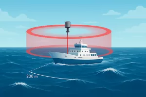
Discover how a LiDAR sensor maps ocean waves 100–200m ahead of ships, improving navigation safety, marine research, and offshore operations.

Discover how a LiDAR sensor maps ocean waves 100–200m ahead of ships, improving navigation safety, marine research, and offshore operations.

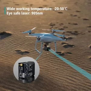
Discover the best distance sensors for UAV and drones, including laser range finders for obstacle avoidance, mapping, and LiDAR applications.

Discover how laser distance sensors are transforming modern surveying. Learn about high-accuracy distance measurement solutions for UAV mapping, GIS, and 3D terrain modeling.

Discover how laser distance measurement surveying improves accuracy in land, construction, and tunnel projects. Learn tools, techniques, and terrain-specific solutions.

로봇용 레이저 거리 센서가 매핑, 내비게이션 및 SLAM을 향상시키는 방법을 살펴보세요. 모든 로봇 유형을 위한 Meskernel의 정밀 솔루션에 대해 알아보세요.

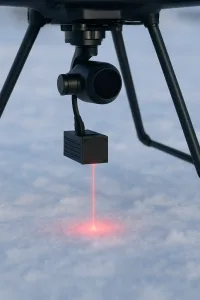
드론 애플리케이션의 레이저 거리 센서는 지형 매핑, 작물 높이 모니터링, 정밀 착륙, 수면 측정과 같은 드론의 작업 수행 방식을 혁신적으로 변화시키고 있습니다. 레이저 센서는 까다로운 환경에서도 정확한 실시간 거리 데이터를 제공함으로써 UAV 운영의 안정성과 효율성을 향상시킵니다. 가벼운 디자인, 높은 재생률, 견고한 성능을 갖춘 UAV의 레이저 거리 센서는 농업, 측량, 환경 모니터링과 같은 산업 전반에서 중요한 도구로 자리 잡고 있습니다.