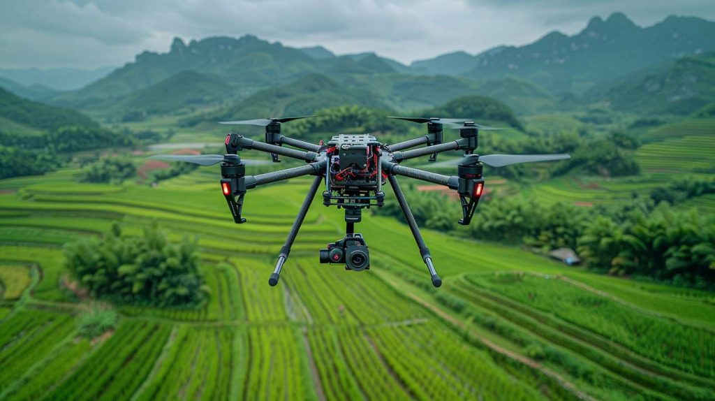
In topographic surveying, drones equipped with laser ranging sensors and LiDAR (Light Detection and Ranging) technology are transforming the way data is captured and analyzed. These advanced tools significantly enhance the efficiency, precision, and scope of high-precision topographic surveys, 3D terrain modeling, vegetation analysis, land cover assessment, and disaster evaluation.
With the growing demand for precise geographical data in industries like urban planning, environmental management, and disaster response, the integration of LiDAR and laser ranging sensors into drone-based systems is reshaping the future of surveying.

1. High-Precision Topographic Surveying with Laser Range Technology
Detailed Terrain Mapping
LiDAR-equipped drones provide unparalleled accuracy in generating high-resolution 2D and 3D terrain maps. By emitting laser pulses and measuring their reflection times, LiDAR sensors gather precise distance data, enabling Geographic Information Systems (GIS) to create accurate and detailed topographic representations. This precision enhances mapping for applications such as urban planning, infrastructure development, and environmental assessments.
Wide Area Coverage and Efficiency
Drones equipped with LiDAR sensors can cover large areas in a short amount of time, making them ideal for surveying vast terrains, remote regions, or difficult-to-reach locations. This feature is especially valuable for engineering surveys, land resource management, and large-scale environmental projects, ensuring efficient data collection while reducing costs and manual labor.
2. 3D Terrain Modeling and Dynamic Change Monitoring
Accurate 3D Modeling
LiDAR technology produces highly detailed 3D models of terrain surfaces. The precision of these models is invaluable for geologists, engineers, and planners, allowing for better decision-making when analyzing the topography and structure of the land. These models are used in a variety of sectors including construction, forestry, and flood risk mapping.
Real-Time Change Detection
Laser range sensors on drones are capable of monitoring and detecting dynamic changes in terrain, such as soil erosion, landslides, or deforestation. The ability to capture and compare pre- and post-event data provides crucial insights into the rate of change, aiding in environmental management, disaster prevention, and recovery efforts.
3. Vegetation and Land Cover Analysis
Vegetation Height and Density Assessment
Laser range technology plays a critical role in measuring vegetation height, density, and structure. This is essential for ecological monitoring, forest health assessments, and biodiversity studies. It helps identify changes in ecosystems, providing key data for conservation efforts, forestry management, and land-use planning.
Comprehensive Land Cover Classification
By combining LiDAR data with multispectral imagery and other sensor data, it is possible to classify and analyze various types of land cover, such as forests, agricultural fields, wetlands, and urban areas. This capability supports land-use planning, environmental monitoring, and conservation management.
4. Disaster Assessment and Emergency Response
Pre- and Post-Disaster Terrain Analysis
Laser range technology enables rapid data acquisition before and after a natural disaster, allowing for a comprehensive comparison of terrain changes. This capability is crucial for evaluating damage extent, guiding recovery efforts, and making informed decisions about reconstruction and mitigation measures.
Enhanced Emergency Response
During natural disasters like earthquakes, floods, and wildfires, drones equipped with Laser range sensors can quickly generate accurate topographic data of affected areas. This helps emergency responders assess the situation in real time, identify hazards, and prioritize relief efforts, ultimately improving the efficiency of disaster management.
Why LiDAR and Drones are the Future of Topographic Surveying
The integration of drone technology with LiDAR sensors brings several advantages:
- Faster Data Collection: Drones can cover large areas quickly and collect high-resolution data, which would otherwise take much longer with traditional surveying methods.
- Cost Efficiency: Drone-based surveys reduce the need for ground crews, lowering operational costs.
- Access to Hard-to-Reach Areas: Drones can reach locations that are dangerous or inaccessible to humans, such as steep terrain, dense forests, or disaster-stricken regions.
- Non-Destructive: Laser range surveys are non-intrusive, ensuring minimal disruption to the surveyed area, which is especially important for environmental and conservation projects.
FAQ: LiDAR Technology and Drone-Based Laser Ranging Sensors in Surveying
What is laser range technology, and how does it work in surveying?
LiDAR (Light Detection and Ranging) uses laser pulses to measure distances to the Earth’s surface, generating precise 3D data. In surveying, drones equipped with LiDAR sensors capture detailed topographic information, creating accurate 2D and 3D terrain models used for mapping, analysis, and decision-making.
What are the benefits of using drones for topographic surveying?
Drones equipped with LiDAR sensors provide fast, cost-effective, and precise data collection for large areas. They can access hard-to-reach locations, reduce manual labor, and generate high-resolution terrain maps, benefiting industries such as construction, urban planning, and environmental conservation.
How accurate is Laser Range for topographic surveys?
LiDAR technology is highly accurate, with point cloud data achieving sub-meter or even centimeter-level precision, depending on the sensor quality and survey conditions. This makes it ideal for creating detailed 3D models and conducting precise terrain analysis.
Can LiDAR detect changes in terrain over time?
Yes, LiDAR is effective in monitoring dynamic changes in terrain, such as erosion, landslides, or vegetation growth. By comparing pre- and post-event data, LiDAR provides valuable insights into environmental changes, aiding in disaster management and land-use planning.
What industries benefit the most from drone-based LiDAR surveys?
Industries such as construction, forestry, agriculture, urban planning, mining, and environmental management benefit significantly from drone-based LiDAR surveys. The technology aids in terrain mapping, vegetation analysis, land cover classification, and disaster assessment.
How does laser range technology help in disaster recovery?
LiDAR quickly provides accurate terrain data before and after disasters, allowing for efficient damage assessment, guiding recovery plans, and supporting real-time emergency responses. It helps decision-makers prioritize areas for reconstruction and mitigation.
The Future of Topographic Surveying with Laser Range Technology and Drones
The fusion of LiDAR technology and drone-based laser ranging sensors is revolutionizing topographic surveying. By offering unmatched precision, speed, and efficiency, these tools are advancing industries across the globe. Whether it’s improving urban infrastructure, managing natural resources, or responding to disasters, LiDAR-equipped drones are paving the way for smarter, more sustainable surveying practices.
Contact us today to discover how our Precision Laser Measurement Sensors can transform your business